Forest of Dean Ramblers publishes a book of walks which is available to download or view from this page, either as the complete book or as individual chapters. A limited number of hard copies of the book are also avaiable from selected local outlets, while stocks last.
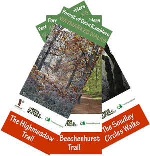
We also publish a number of walks leaflets, all of which are available as a free download from this website. (Click on an image on this page to see the associated Start Point Map).
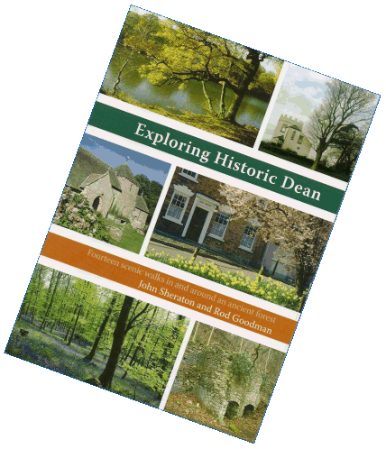
- Exploring Historic Dean
Our publication Exploring Historic Dean has to be your handbook to explore this great area. Tucked between the Rivers Severn and Wye, the Forest of Dean is undoubtedly one of Britain’s most beautiful areas and includes some of the most attractive woodland in the country, as well as providing superb views over the Welsh Hills, Malverns, and Cotswolds. Such a landscape offers almost unlimited opportunities for walking, but, it may come as a surprise to learn that the area was once a busy industrial centre, with mines, quarries, ironworks, and others. This publication will guide you on some of the best walking in the area and will give you an insight into its’ fascinating history going back several thousand years.
Printed copies of Exploring Historic Dean are no longer available but it is still available as a download from this page. The introduction, which includes a list of the walks in the book, and a location map with the start points, is available as a PDF download here. The remaining chapters, detailing the walks in the book along with descriptions of the route and points of interest along it, are available individually. In addition, GPX files of the route of each walk are available.
- Walk Leaflets
| The following walks leaflets are available for Download only from this website: | |
 |
The Beechenhurst Trail is an 8 mile circular walk in the east of the Forest of Dean through some of the oldest and most varied woodland. A moderate walk starting from the Parking Area at Beechenhurst Lodge (Pay and Display). View Download GPX |
| The Highmeadow Trail is an 11 mile circular walk in the west of the Forest of Dean with stunning views, a ferry crossing and a footbridge over the River Wye. This is a demanding but rewarding walk with steep assents and descents, starting at Symonds Yat Rock car park. Included in the details are two variants of the route: a 13 mile route that does not use the ferry, and a 9 mile route that does not cross the river. Note: The GPX file for this walk includes all 3 routes. View Download GPX |
|
| The Soudley Circles Walks are three circular walks of approximately 3 miles each in the vicinity of Upper Soudley. View Download GPX |
|
| All three routes include uphill sections and are not wheelchair friendly. | |
Publication downloads are in PDF format.
- Downloads
| Exploring Historic Dean-Introduction | View Download |
|
| Exploring Historic Dean-Walk 1 Little Doward, Symonds Yat, & the Wye Gorge (5 miles/8 km) |
View Download |
GPX |
| Exploring Historic Dean-Walk 2 Norchard, Oldcroft, & Pillowell (5½ miles/9 km) |
View Download |
GPX |
| Exploring Historic Dean-Walk 3 Soudley, Staple Edge, & Bradley Hill (5½ miles/9 km) |
View Download |
GPX |
| Exploring Historic Dean-Walk 4 Gatcombe, Purton, & Blakeney (6 miles/9½ km) |
View Download |
GPX |
| Exploring Historic Dean-Walk 5 Beechenhurst, Trafalgar, & Speech House (6½ miles/10½ km) |
View Download |
GPX |
| Exploring Historic Dean-Walk 6 St Briavels, Mork, & Hudnalls Wood (6½ miles/10½ km) |
View Download |
GPX |
| Exploring Historic Dean-Walk 7 Cannop, Nagshead, & Parkend (6½ miles/10½ km) |
View Download |
GPX |
| Exploring Historic Dean-Walk 8 Lydbrook, Joy’s Green, & Ruardean (6½ miles/10½ km) |
View Download |
GPX |
| Exploring Historic Dean-Walk 9 Clearwell, Whitecliff, & Newland (7 miles/11 km) |
View Download |
GPX |
| Exploring Historic Dean-Walk 10 Plump Hill, Flaxley, & Abenhall (7½ or 5 miles/12 or 8 km) |
View Download |
GPX |
| Exploring Historic Dean-Walk 11 Hope Mansell, Lea Bailey, & Wigpool (7½ or 5 miles/12 or 8 km) |
View Download |
GPX |
| Exploring Historic Dean-Walk 12 Newnham, Bullo Pill, & Blaize Bailey (8 miles/13 km) |
View Download |
GPX |
| Exploring Historic Dean-Walk 13 Redbrook, The Kymin, & Staunton Stones (8 or 7 miles/13 or 11 km) |
View Download |
GPX |
| Exploring Historic Dean-Walk 14 Tidenham Chase, Hewelsfield & Offa’s Dyke (10 or 8 miles/16 or 13 km) |
View Download |
GPX |
| The Beechenhurst Trail (8 miles/13 km) | View Download |
GPX |
| The Highmeadow Trail (11 miles/18 km) | View Download |
GPX |
| The Soudley Circles Walks (3 x 3 miles/5 km) | View Download |
GPX |
